Resources
Using Multispectral Data to Enhance Early-Stage Crop Management with the Sentera 6X Multispectral Sensor
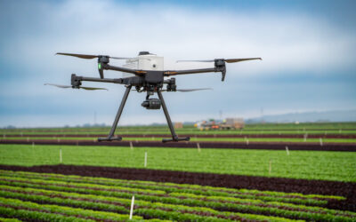
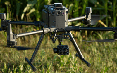
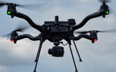
Managing crops during their early growth stages requires precision and actionable insights. Our partner, Inspired Flight, recently shared a compelling case study on their blog, showcasing how the Sentera 6X Multispectral sensor, paired with the IF800 Tomcat drone,...
Unleash the Power of Multispectral, RGB, and Thermal Imagery with the Sentera 6X Thermal and 6X Thermal Pro Sensors
In industries where precision and actionable data are critical, having a sensor that combines multiple imaging capabilities is a game-changer. Sentera Sensors & Drones offers powerful options with its 6X Thermal and 6X Thermal Pro sensors, which integrate...
Sentera Announces Strategic Partnership with Heliboss to Expand Distribution in Chile
Through this collaboration, Heliboss will become an authorized reseller of Sentera’s state-of-the-art sensors, further extending Sentera’s reach and enhancing its service offerings in the Chilean market.
Sentera Announces Strategic Partnership with Dynatech
Sentera is partnering with Dynatech Innovations, a premier technology distributor based in the United Arab Emirates. This collaboration marks a significant milestone in Sentera’s global expansion strategy and aims to bring state-of-the-art sensor technology to a broader market across multiple sectors.
Sentera Announces Partnership with Drone Nerds
Sentera is partnering with Drone Nerds to bring our advanced drone sensors to a wider audience. Our cutting-edge 6X multispectral, 6X Thermal, and 65R sensors are now available through Drone Nerds’ extensive distribution network, providing unparalleled aerial imaging capabilities for agriculture, construction, and more.
Sentera Announces Partnership with Frontier Precision
Sentera today announced that it has partnered with Inspired Flight to Integrate the 6X and 65R sensors with their drone systems.
Sentera Launches Integration with Inspired Flight
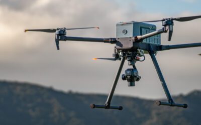
Sentera today announced that it has partnered with Inspired Flight to Integrate the 6X and 65R sensors with their drone systems.
Sustainable Agriculture: Remote Sensing for Optimum Nitrogen Use
When it comes to sustainable agriculture, technology plays a large role. Read how leveraging remote sensing technologies can transform nitrogen use.
Sentera Sensors Now Compatible with Gremsy Quick Release
Today Sentera announced that its 65R and 6X sensors are compatible with the Gremsy Quick Release. This means that these industry-leading sensors are compatible with more drone systems.
Looking Ahead to 2024: Top Ag Trends to Watch
As we approach the New Year, we wanted to highlight three 2024 ag trends to keep an eye out for.
Sentera Announces Two New Board Appointments
Sentera today announced the appointment of Michael Stern and Anthony Osborne to key advisory and director roles on its Board of Directors, respectively.
Satellite and Weather Data: More Than a Weather Report
Satellite and weather data can give a good indication of what’s happening at the field, and provide insights into why crops are performing the way that they are throughout the growing season.
Best High-Resolution Aerial Imagery Data Sets for Hybrid Corn Seed Production
Learn about the best data sets captured by aerial imagery that can assist in maximizing your hybrid corn seed production outcomes.
Can Sustainable Agriculture Feed the World?
While as continues to try to get more with less to meet the demands of the growing population, it begs the question: can sustainable agriculture feed the world?
What Are Crop Area Insights?
With the ability to identify the boundaries for a field, Crop Area insights can provide immense value throughout the crop season.
The Role of Thermal Imagery in Agriculture
What is the value of thermal imagery in ag? What’re the best products to capture this data? Find out in our blog.
Eiwa, Sentera Announce Commercial Collaboration, Distribution Agreement & Technology
Sentera and Eiwa announce a commercial partnership to accelerate adoption of analytics by agronomic leaders in North and South America.
Getting the Most Out of Your Flights with Fixed Wing Drones
Fixed wing drones have transformed data collection by capturing more data faster, without sacrificing quality.
The Plight of the Product Lead Using Drone Imagery and Machine Learning
How can you accelerate production of training data for AI projects in agriculture using synthetic data? What’s the difference between 2D and 3D synthetic data? Check out our blog post for a deep dive into synthetic data enabling AI for agriculture.
How to Avoid the Scare of Ghost Corn Imagery This Season
Seeing ghost corn imagery when you’re processing your aerial imagery can give you quite a fright! See how to avoid in our latest blog post.
Estimating Biomass with Remote Sensing
Estimating biomass with remote sensing provides an efficient and effective way to better understand crop biomass at different spatial scales. Learn more in our blog post.
What is the Role of Aerial Imagery in Advancing Soil Fertility?
With a focus on bringing new soil fertility products to market, how can remote sensing help to accelerate development and improve outcomes?
This or That: Agricultural Drone Services vs. Drone Fleet Management
Not everyone has the resources or capability to capture their own data, calling on external agricultural drone services to do so.
Detecting the Otherwise Undetectable with Red-Edge Chlorophyll Index
In order to optimize productivity, innovative tools like red-edge chlorophyll index have been introduced to ag to better monitor crop health and projected performance.
The Value of Supplemental Data from Remote Sensing
With data, there’s often more than what meets the eye. Dive deeper into the details with the help of supplemental data.
3 Key Questions for Choosing Drones for Mapping Use Cases
With the variety of uses for drone systems, leveraging drones for mapping assists in more efficient and effective surveying.
Crop Insights Deep Dive: Elevation and Hydrology Analytics
Aerial drone technology can do more than revealing crop health and performance metrics – it can also provide insight into elevation and hydrology analytics.
In the Field with Sentera: A Recap of 2023
As crazy as it is to think, we are approaching the end of the 2023 season and for some of us, harvest has already commenced. And this year has been filled with highs and lows stemming from a variety of challenges, uncertainty, innovation, and resiliency. So, with...
What Do Drones Have to Do With Food Production? Everything.
As we look towards optimizing food production for our world’s food needs, drones play a huge role in advancing phenotyping in agriculture.
Sentera Launches New Precision Weed Technology
Sentera announced the launch of its Aerial WeedScout technology, a precision weed control solution that reduces post-emergent herbicide use by up to 70%
Sentera Launches 65R Integration with Freefly Systems
Sentera today announced that it has expanded its integrations with Freefly Systems to now include its ultra-high-resolution aerial sensor, the 65R.
Friend or Foe: The Debate About Generative AI in Agriculture
From OpenAI to Google Bard, generative AI has taken the world by storm. But, what’s the role of generative AI in agriculture? It may be bigger than you think.
The Role of Remote Sensing in Mitigating the Impact of Tar Spot
Tar spot has started to wreak havoc on U.S. corn yields. With a focus on research and product development, what role does remote sensing play?
What Crops Use the Most Water — and What We Can Do About It
To reduce water use across agriculture, understanding things like what crops use the most water can be crucial in sustainable water use.
How Can You Build Remote Sensing into Your Agriculture Research Questions?
Remote sensing has transformed data capture as we know it, making it valuable for exploring your agriculture research questions.
Roadmap for the Upcoming Season: Using Data Analytics in Agriculture
Which analytics should you be using and when? This blog post creates a roadmap for using data analytics in agriculture to optimize your upcoming season.
Crop Insights Deep Dive: Residue Cover Analytics
Using aerial imagery can help to identify residue cover across acreage, helping to inform key management practices to inform soil health.
Leftovers Aren’t Just for Food: Three Reasons to Give Leftover Data Another Look
Do you have leftover data from this or other past seasons? This blog post dives into three reasons why you should give it another look.
Innovation in the Sky: Combatting Issues Facing Permanent Crops
With the variety of issues facing permanent crops, learn more about the technology available that mitigates their impact on productivity.
Ag Innovators of Tomorrow: Using Pigments to Enable Crops to Talk
Insignum AgTech is leading the revolution towards a more economically, agronomically, and sustainably smart future by using plant pigments to enable crops to voice their stresses.
Enhancing Crop Research with Drone-Based Agricultural Analytics: Next Steps after Plot Stand Count Results
Stand count technology has advanced to more accurately & efficiently capture crop emergence to boost productivity – but what are the next steps after capturing stand count?
Is Carbon Farming the Future?
As the summers seem to get longer and hotter, many are searching for more climate-smart initiatives to reduce emissions – like carbon farming.
Crop Insights Deep Dive: Tassel Count
As you look ahead to the end of the season, Tassel Count Analytics can give you essential insight for this year and the season to come.
How Do You Know When to Harvest Corn?
Knowing when to harvest corn depends on a variety of factors and ag technology can assist in picking up on them and informing harvest decisions.
The Dynamic Duo: The Freefly Astro and Sentera’s 6X Sensor
The Freefly Astro and Sentera’s 6X Sensor are now compatible, so what does that mean for you? Find out in this blog post.
PHX Remote Identification: What You Need to Know
The FAA has passed new regulations for drones to have remote identification for tracking. Learn what this means for your PHX and how to become compliant.
Not All Data is Created Equal: Selecting the Right Image Datasets for Precision Agriculture Applications
Not all data is created equal, determining which are the right image datasets for your precision ag applications is crucial in success.
Sentera Expands Mapping Capabilities with New Drone System
Today Sentera is excited to announce an integration between it’s fixed-wing drone, the PHX, and its ultra-high-resolution aerial sensor, the 65R, to capture more precise digital surface models (DSMs) for mapping and surveying applications.
Is Sustainable Agriculture a Catalyst for Profitability?
With a great deal of focus on sustainable agriculture, it begs the question of what it means to a company’s bottom line. Learn more in this blog post from Sentera.
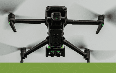
Case Study: The Flexibility of the Double 4K and Mavic 3 Enterprise
Accurate aerial imagery can uncover differences in product performance — the Sentera Double 4K and Mavic 3 Enterprise deliver.
Get the Latest Delivered to Your Inbox
Sign up for our monthly newsletter to stay up-to-date with key industry insights.

