
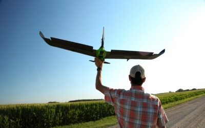
Capture More – Faster, With Confidence

High-Precision Single
Entry-level ag sensor for NDVI/NDRE

Double 4K
Versatile sensor for multispectral imagery

6X Multispectral
Research-grade quality multispectral

6X Thermal
Calibrated multispectral with thermal capabilities

65R
Ultra-high-resolution aerial sensor purpose-built for drones

Rely on Proven, Precision Sensors
Use our field-tested, aerial-based solutions to get the data you need, whether you require specific plot measurements or data-driven insights for grower engagement.
Get Reliable Data & Insights
Rely on our ag sensors to get you the high-resolution imagery you need, when you need it – because we know that while measurements matter, timeliness matters even more.


Power Faster Agronomic Decisions
Validate outcomes and performance with access to more data and deeper insights – without sacrificing quality so you can focus on making critical decisions.
Our Recommended Ag Drone Packages
Accomplish your aerial missions faster by choosing one of our pre-configured packages, built with Sentera’s leading sensors.

Research Package
Calibrated Multispectral and High Resolution RGB Insights

Broad Acre Package
Maximum Coverage Crop Health Maps and Insights

Scouting Package
Field-Level Scouting for Vegetative Insights
Discover how Sentera can help you make critical decisions
Stay in the Know
End of Life Announcement: PHX Fixed Wing, Single Sensor, and Gimbal-mounted Double 4K products
Sentera is officially announcing the upcoming end of life (EOL) of all PHX Aircraft Systems, Single Sensor, and Gimbal-mounted Double 4K products. Key Dates and Details: EOL Effective Date: October 1, 2025 Support Period: Sentera will continue to provide support,...
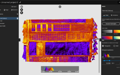
6X Thermal Series: Raw Imagery to Actionable Data
Sentera is proud to announce our collaboration with Teledyne FLIR on our 6X Series Thermal Sensors. The 6X Thermal and 6x Thermal Pro Sensors utilize FLIR BOSON modules for precise pixel level thermal data. Combined with the 6X Series Rig Processing capabilities, it...
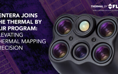
Sentera 6X Thermal Sensors Now Listed in the Thermal by FLIR Program
MINNEAPOLIS, MN – March 25, 2025 – Sentera Sensors & Drones proudly announces that its 6X Thermal and 6X Thermal Pro sensors are now officially listed in the Thermal by FLIR program, reinforcing their status as the premier solution for high-precision thermal...