
|
Scout
Uncover crop health through the season.
$1,000
per year
Satellite data
Field Notifications
Field Management & Zones
Data Visualization & In-app Reporting
Drone Flight Planning
Unlimited Crop Health (Cloud Stitching)
Unlimited RGB Mosaics (Cloud Stitching)
Unlimited Stand Count
Unlimited Tassel Count
Cloud Stitching: XL Mosaics
Agronomic Advisor
Advisor
Get deeper insights with Stand and Tassel Count.
$1,500
per year
Satellite data
Field Notifications
Field Management & Zones
Data Visualization & In-app Reporting
Drone Flight Planning
Unlimited Crop Health (Cloud Stitching)
Unlimited RGB Mosaics (Cloud Stitching)
Unlimited Stand Count
Unlimited Tassel Count
Cloud Stitching: XL Mosaics
|
Advanced
Access larger mosaics.
$3,500
per year
Satellite data
Field Notifications
Field Management & Zones
Data Visualization & In-app Reporting
Drone Flight Planning
Unlimited Crop Health (Cloud Stitching)
Unlimited RGB Mosaics (Cloud Stitching)
Unlimited Stand Count
Unlimited Tassel Count
Cloud Stitching: XL Mosaics
Enterprise
Analytics for research plots and seed production operations
All features included with FieldAgent Advanced
Unlimited FieldAgent Users
API Calls
Data Storage
Flight Services
Available Analytics:
Stand Count
Canopy Cover
Crop Area
Crop Health
Tassel Count
Height
Testimonials
Adrian Rivard
Operational Manager
Drone Spray Canada, Inc.
We directly compared to competitors and the Sentera 6X Sensor was the clear choice. The dedicated 20MP RGB camera is critical to our operation and with the fast capture rate I can fly fields at 200’ and am only limited to our Matrice 300’s max speed at 35 mph.

Colby Woods
Channel Seed Dealer, Founder and Owner
Woods Ag Services
I’m engaging with my customers, speaking to the performance of the seed I sold them, all while Sentera’s products are capturing 100x the data points that I could collect manually. Sentera has elevated perception of my business and made me more valuable to my customers.
Stay in the Know
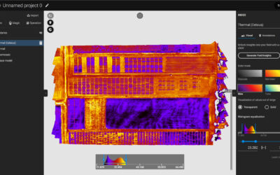
6X Thermal Series: Raw Imagery to Actionable Data
Sentera is proud to announce our collaboration with Teledyne FLIR on our 6X Series Thermal Sensors. The 6X Thermal and 6x Thermal Pro Sensors utilize FLIR BOSON modules for precise pixel level thermal data. Combined with the 6X Series Rig Processing capabilities, it...
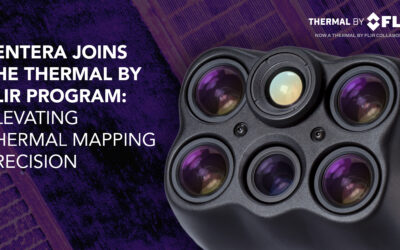
Sentera 6X Thermal Sensors Now Listed in the Thermal by FLIR Program
MINNEAPOLIS, MN – March 25, 2025 – Sentera Sensors & Drones proudly announces that its 6X Thermal and 6X Thermal Pro sensors are now officially listed in the Thermal by FLIR program, reinforcing their status as the premier solution for high-precision thermal...
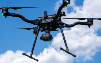
From Fields to Skies: Real-World Applications of High-Capture-Rate Sensors
When it comes to aerial surveys, every second in the air matters. Whether mapping farmland, monitoring infrastructure, or assessing environmental changes, the efficiency of a drone mission can make or break the quality of the data collected. That’s why capture...